
| Method | Copper engraved |
| Artist | Roper, John after Cole, G. |
| Published | London, Published for the Proprietors, by Vernor Hood & Sharpe, Poultry Apr. 1. 1807 |
| Dimensions | 222 x 175 mm |
| Notes |
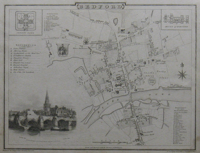
To accompany the Beauties of England and Wales From a Drawing by G. Cole Cole and Roper produced a finely engraved series of county maps and town plans which were intially issued in parts and then together as The British Atlas in 1810. These accurate, detailed maps, based on those of John Cary and Charles Smith, emphasize the mail-coach routes and are significant as one of the last series published before the dawn of the railway age. The town plans are particularly attractive with delicately engraved vignettes of famous buildings and the heraldric arms of the cities. |
| Framing | unmounted |
| Price | £40.00 |
| Stock ID | 6199 |