
| Method | Lithograph with hand colour |
| Artist | Dower, John |
| Published | London: Published at the "Weekly Dispatch" Office, 139, Fleet Street, London, and Sold by All Booksellers and Newsagents. 1863. |
| Dimensions | 315 x 425 mm |
| Notes |
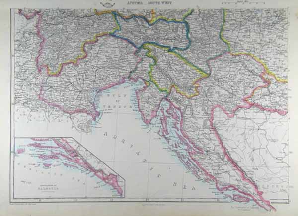
From The Dispatch Atlas. A map the south-western reaches of the Austro-Hungarian Empire. Provinces are separately labelled with their borders in hand-coloured outline. The neighbouring territory of Venice, including the Dalmatian Coast of modern-day Croatia, is outlined in pink. In the bottom left corner, an inset map contains a detail of the southern continuation of Dalmatia and the Adriatic sea. Between 1857 and 1863, the British newspaper The Weekly Dispatch published a series of maps. Over 100 maps were produced, and in 1863, the maps were gathered together to form The Dispatch Atlas. The atlas contained county and country maps, as well as several city maps. Each of the maps featured a distinctive image of a half-globe with a winged mercury above. Condition: Light time toning to edges of sheet. |
| Framing | unmounted |
| Price | £55.00 |
| Stock ID | 38808 |