
| Method | Copper engraved with hand colour |
| Artist | Bowen, Emanuel |
| Published | 1747 |
| Dimensions | 350 x 427 mm |
| Notes |
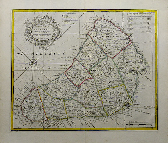
A decorative map of Barbados from Emanuel Bowen's "A Complete System Of Geography". Outline colour divides the island into parishes. Barbados is orientated on its side with North to the left of the sheet. An ornate title cartouche and brief key to the map and parishes features to the top of the map with a decorative compass rose to the left, and a scale of English Miles in the bottom right. Bowen, Emmanuel (c.1693 - 1767) was one of the leading eighteenth century map and print sellers and engravers in London. He was appointed Engraver of maps to George II of England and possibly held a similar role for Louis XV of France. His apprentices included Thomas Kitchin and Thomas Jeffreys. He collaborated with other map makers of his time, including the Bowles family and John Owen. Condition: Excellent impression with good hand colour and full margins. Centre fold as issued, one small stain to the bottom right parish of the island. |
| Framing | unmounted |
| Price | £750.00 |
| Stock ID | 29683 |