
| Method | Copper engraved with hand colour |
| Artist | Bowen, Emanuel |
| Published | Printed for Mess: Bakewell & Parker and J. Bowles & Son in Cornhill T. Bowles in St. Pauls Church Yard, H. Overton without Newgate T. Kitchin on Holborn Hill, R. Sayer & J. Ryall in Fleet Street. [London, c.1778] |
| Dimensions | 495 x 400 mm |
| Notes |
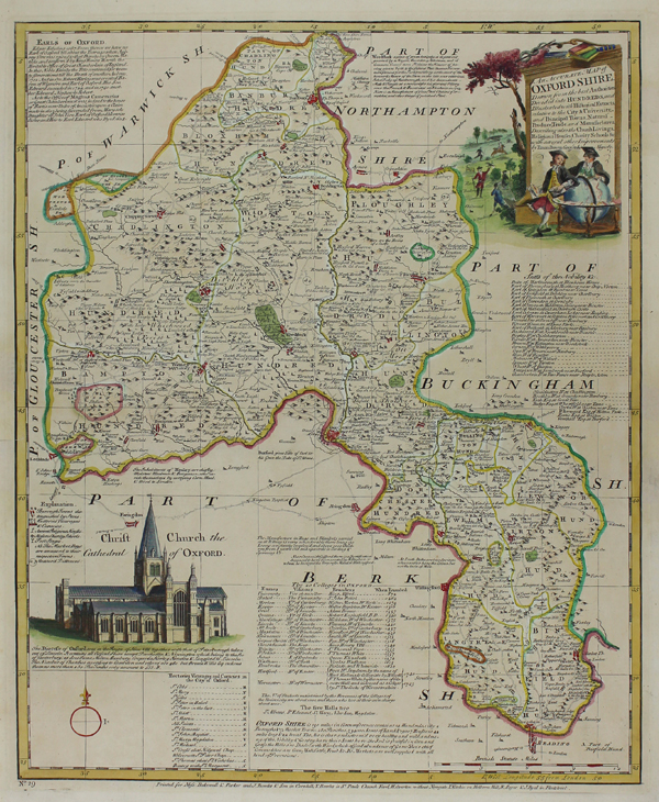
Text below title: Drawn from the best authorities. Divided into hundreds and illustrated with Historical Extracts relative to the City & University and principal towns, Natural produce, Trade and Manufactures. Describing also the Church Livings, Religious Houses, Charity Schools &c. with several other Improvements by Eman. Bowen Geog to his Majesty. An informative map of the county of Oxfordshire. The maps depicts the various hundreds picked out in hand colour, with towns, hills and wooded areas also highlighted. Surrounding the map are lists of the colleges of Oxford, the Seats of Nobility and Rectories and Vicarages in the City. There is a depiction of Christ Church Cathedral and the title is contained within a decorative vignette showing two men sat around a globe. Emanuel Bowen (c.1693-1767) was one of the leading eighteenth century map and print sellers and engravers in London. Appointed Engraver of maps to George II of England and possibly Louis XV of France. His apprentices included Thomas Kitchin and Thomas Jeffreys. He collaborated with other map makers of his time, including the Bowles family and John Owen. Condition: Central horizontal fold as issued. Minor time toning to sheet. Repaired tears to margins. Verdigris on verso from old green hand colour. |
| Framing | unmounted |
| Price | £650.00 |
| Stock ID | 46801 |