
| Method | Copper engraved |
| Artist | Blome, Richard |
| Published | [John Strype, London, c.1720] |
| Dimensions | 302 x 178 mm |
| Notes |
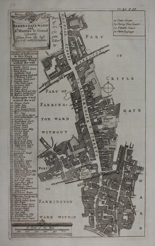
A map of Aldersgate ward and the Liberty of St Martins, in the City of London, originally engraved by Richard Blome for inclusion in an intended Survey or Description of the Citties of London and Westmr. When Blome died in 1705, the plates were sold to John Strype, who issued them with Blome's name erased in his two editions of John Stow's A Survey of the Cities of London and Westminster. The maps were the basis for many ward plans by other mapmakers, particularly the well known series by Benjamin Cole that appeared in Entick's New and Accurate History and Survey of London (1766) and Maitland's History of London (1769). Richard Blome was one of the most active map-publishers of his day, working between about 1667 and 1705. His principal publications were the 'Geographical Description of the World', and two county atlases, the 'Britannia', published in 1673, and 'Speed's Maps Epitomiz'd', published in 1681. Blome first began engraving maps for his Geographical Description Of The Four Parts Of The World in 1667. The completed volume was in small folio, and contained 24 maps (plus one duplicated), engraved by Francis Lamb, Thomas Burnford, and Wenceslaus Hollar. Blome has been heavily criticised as a plagiarist, but he lacked the capital to be innovative (as indeed did virtually all his contemporaries), and his output filled an important gap in the market. The 'Geographical Description' was the first new, and uniformly assembled, folio world atlas to be published in London since 1627, while the next folio world atlases appeared in the decade 1710-1720. Condition: Minor time toning to edges of sheet. Blank on verso. |
| Framing | unmounted |
| Price | £120.00 |
| Stock ID | 49097 |