
| Method | Copper engraving |
| Artist | Thomas Jefferys |
| Published | T. Jefferys Sculp. [London, c.1748] |
| Dimensions | Image 170 x 385 mm, Plate 200 x 395 mm, Sheet 200 x 410 mm |
| Notes |
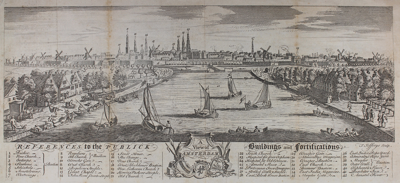
A mid-eighteenth century view of Amsterdam, centred on the Amstel River and with the city in the distance, engraved by Jefferys for the 1748 edition of The Gentleman's Magazine: and Historical Chronicle. Below the view, a numerical key of 44 points provides 'References to the Publick Buildings and Fortifications' of the city. In the centre of the key, the title in enclosed in a baroque cartouche featuring attributes of commerce and the arms of the City and the Dutch Republics. Thomas Jefferys (c.1719-1771), was an English cartographer and one of the leading map suppliers of his day. He engraved and printed maps for government and other official bodies and produced a wide range of commercial maps and atlases, especially of North America. As "Geographer to the Prince of Wales", he produced 'A Plan of all the Houses, destroyed & damaged by the Great Fire[ [...]. He also produced 'The Small English Atlas' with Thomas Kitchin, and engraved plans of towns in the English Midlands. In 1754, Jefferys published a map of Virginia which had been surveyed by Joshua Fry and Peter Jefferson in 1751. The next year he published a 'Map of the Most Inhabited Part of New England' surveyed by John Green, and in 1768 he published 'A General Topography of North America and the West Indies' in association with Robert Sayer. In 1775, after his death, collections of his maps were published by Sayer as 'The American Atlas and The West-India Atlas'. Condition: Vertical folds, as issued. Trimmed within plate at top and bottom, as issued. Minor foxing and time toning to folds. Text offsetting on verso, otherwise blank. |
| Framing | unmounted |
| Price | £150.00 |
| Stock ID | 50833 |