
| Method | Copper engraved with original hand colour |
| Artist | Smith, Charles |
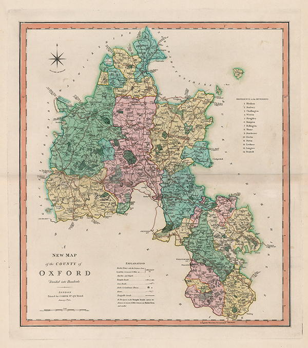
| Published | London: Printed for C. Smith No.172 Strand. January 6th, 1801. |
| Dimensions | 507 x 450 mm |
| Notes |
An early nineteenth century map of Oxfordshire in full original wash colour. The map was originally separately published in 1801 and later included in Smith's New English Atlas (London: Charles Smith, 1804). A key in the lower left provides the details of Market towns, miles to London, churches and chapels, turnpike roads, cross roads, parks and gentleman's houses, rivers. The county's Hundreds are outlined and coloured with a key to the right. Charles Smith (fl.1800-1852) was a British publisher of atlases, pocket maps, and charts of England. Best known for Smith's New English Atlas (1801 - 35), he also published England and Wales (1806), The New General Atlas (1808), and the New Pocket Companion to the Roads of England and Wales (1826). Smith's early work was stylistically similar to Pinkerton, Cary, and Thomson. After his death in 1852 the business was taken over by his son who is best known for publishing the 'Tape Indicator Map', which could be used with a tape measure. Condition: Pressed central horizontal fold, as issued otherwise excellent. |
| Framing | unmounted |
| Price | £275.00 |
| Stock ID | 53106 |