
| Method | Copper engraved with hand colour |
| Artist | Cole, Benjamin |
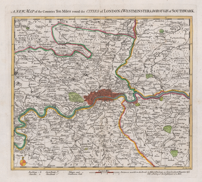
| Published | B. Cole Sculp. [London, c.1756] |
| Dimensions | 267 x 292 mm |
| Notes |
A mid-eighteenth century map of London and environs, essentially covering the extent of modern Greater London, engraved by Cole for William Maitland's The History and Survey of London : from its Foundation to the Present Time. The City, Westminster, and Southwark are picked out in red at the centre, as is Greenwich, and county boundaries are outlined in hand colour. The map extends to a distance of ten miles from London, stretching from Twickenham in the west to Erith in the east, and from Cheshunt to Epsom north to south. Concentrations of buildings are shown, as are churches, villages, and the seats of Gentlemen, and roads are shown as either open or closed by a dashed or solid line respectively. Benjamin Cole (1697-1783) was an English printmaker, who engraved, printed and sold prints from his shop at St Paul's Church in London. He also produced a wide variety of book illustrations, and is not to be confused with the near contemporary map engraver of the same name (1667-1729), who was active in Oxford. Condition: Central vertical fold, as issued. Repaired tear to top of central fold, not affecting plate. Blank on verso. |
| Framing | unmounted |
| Price | £300.00 |
| Stock ID | 51402 |