
| Method | Copper engraved with hand colour |
| Artist | Dix, Thomas |
| Published | W. Darton & Son, 58. Holborn Hill. [1822] |
| Dimensions | Each 540 x 688 mm |
| Notes |
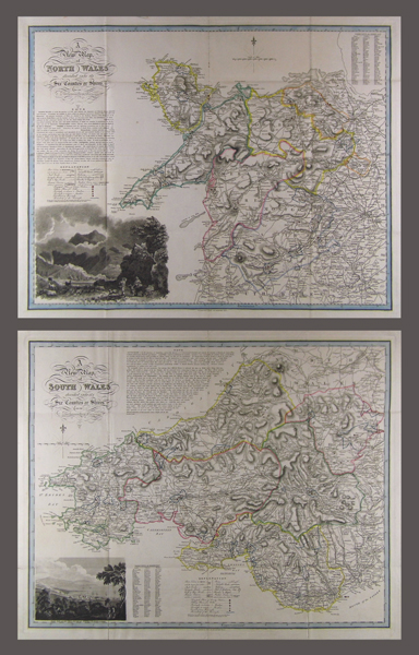
Large-scale maps of North Wales and South Wales. Both maps feature a 'Note' on the area, an 'Explanation' key, and a key to market towns, and market days. The maps were published in Thomas Dix and William Darton's 'A Complete Atlas of the English Counties', 1822. Dix died before the atlas was completed, so Darton finished the work, and published it under both their names. The map of North Wales features an inset view of Snowdon in the lower left corner, based on a drawing by Philippe Jacques de Loutherbourg. In the lower left corner of the South Wales map, an engraving titled 'West View of the Town and Bay of Swansea, Glamorganshire' is featured. Condition: Vertical and horizontal folds as issued. A few tear repairs along folds. |
| Framing | unmounted |
| Price | £400.00 |
| Stock ID | 41049 |