
| Method | Copper engraved |
| Artist | Blome, Richard and Hollar, Wenceslaus |
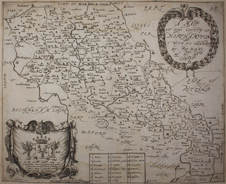
| Published | W. Hollar fc. 1671. By Ric. Blome, by His Matys. Comand. |
| Dimensions | 255 x 312 mm |
| Notes |
A decorative county map of Northamptonshire from the 'Britannia', Blome's larger series of county maps. Like some of the other maps in Blome's atlas, the actual cartographic plate was prepared by Wenceslaus Hollar, with Blome engraving the (admittedly sketchier) decorative elements. In this case, a large dedicatory cartouche in the bottom left corner contains the arms of the Rt Hon. James, Baron Compton, Earl of Northampton. Wenceslaus Hollar (1607-1677) left his native Prague in 1627. He spent several years travelling and working in Germany before his patron, the Earl of Arundel brought him to London in 1636. During the civil wars, Hollar fought on the Royalist side, after which he spent the years 1644-52 in Antwerp. Hollar's views of London form an important record of the city before the Great Fire of 1666. He was prolific and engraved a wide range of subjects, producing nearly 2,800 prints, numerous watercolours and many drawings. Richard Blome was one of the most active map-publishers of his day, working between about 1667 and 1705. His principal publications were the 'Geographical Description of the World', and two county atlases, the 'Britannia', published in 1673, and 'Speed's Maps Epitomiz'd', published in 1681. Blome first began engraving maps for his Geographical Description Of The Four Parts Of The World in 1667. The completed volume was in small folio, and contained 24 maps (plus one duplicated), engraved by Francis Lamb, Thomas Burnford, and Wenceslaus Hollar Blome has been heavily criticised as a plagiarist, but he lacked the capital to be innovative (as indeed did virtually all his contemporaries), and his output filled an important gap in the market. The 'Geographical Description' was the first new, and uniformly assembled, folio world atlas to be published in London since 1627, while the next folio world atlases appeared in the decade 1710-1720. Condition: Central vertical fold, as issued. Trimmed to plate mark and remargined with old album sheet. Waterstaining to edges of sheet. Small tears to top and bottom of central fold. |
| Framing | unmounted |
| Price | £120.00 |
| Stock ID | 49000 |