
| Method | Copper engraved |
| Artist | Blome, Richard |
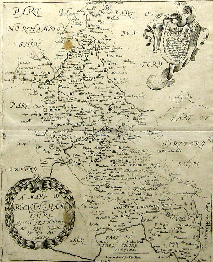
| Published | London Printed Ric. Blome [c.1673] |
| Dimensions | 315 x 260 mm |
| Notes |
Blome's uncommon map of the county of Buckinghamshire, from the first edition of 'Britannia', Blome's larger series of county maps. Although based on Speed's survey, this sketchy map is of little cartographic merit, however it includes all the elements expected from a seventeenth century county map, including elaborately decorated cartouches around the title and dedication. Richard Blome was one of the most active map-publishers of his day, working between about 1667 and 1705. His principal publications were the 'Geographical Description of the World', and two county atlases, the 'Britannia', published in 1673, and 'Speed's Maps Epitomiz'd', published in 1681. Blome first began engraving maps for his Geographical Description Of The Four Parts Of The World in 1667. The completed volume was in small folio, and contained 24 maps (plus one duplicated), engraved by Francis Lamb, Thomas Burnford, and Wenceslaus Hollar Blome has been heavily criticised as a plagiarist, but he lacked the capital to be innovative (as indeed did virtually all his contemporaries), and his output filled an important gap in the market. The 'Geographical Description' was the first new, and uniformly assembled, folio world atlas to be published in London since 1627, while the next folio world atlases appeared in the decade 1710-1720. Condition: Centrefold as issued. Tears to edges of sheet, not affecting printed area. |
| Framing | mounted |
| Price | £200.00 |
| Stock ID | 3709 |