
| Method | Copper engraved with hand colour |
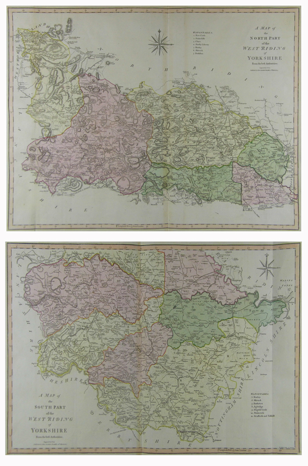
| Artist | Cary, John |
| Published | Engraved by J. Cary. Published by John Stockdale, Piccadilly, 26th March 1805. |
| Dimensions | North 408 x 532 mm, South 328 x 520 mm |
| Notes |
A detailed county map of the West Riding of Yorkshire over two sheets, North and South, from 'Cary's New and Correct English Atlas'. John Cary (1755-1835) was an English cartographer, engraver, globe maker and publisher. Working with his brother George, he was apprenticed to William Palmer in 1770, and was appointed surveyor of roads to the general post office in 1794. Cary is best known for his English county atlases, particularly Cary's New and Correct English Atlas, and for engraving the plates for Robert Gough's editions of Camden's Britannia, published in 1789 and 1806. Condition: Vertical folds as issued. Minor staining to central folds. Small chip to bottom edge of 'North' sheet, not affecting plate. |
| Framing | unmounted |
| Price | £350.00 |
| Stock ID | 41260 |