
| Method | Copper engraved |
| Artist | Downes, Charles John |
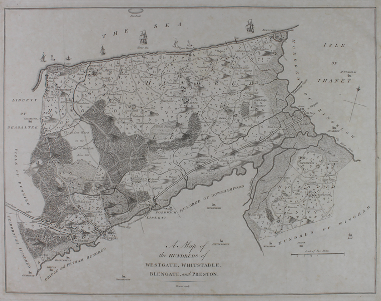
| Published | Downes sculp. [Canterbury, c.1790] |
| Dimensions | 370 x 480 mm |
| Notes |
A map of the Hundreds of Westgate, Whitstable, Blengate, and Preston, engraved for the third volume of Edward Hasted's 'History and Topographical Survey of the County of Kent.' Villages and towns are shown with the footprints of their buildings, and Canterbury is shown pictorially. The roads are marked, and areas of forest are shown. Off the coast, vessels of numerous size sail. Charles John Downes (fl.1781-1817) was a British engraver and printer best known for engraving survey maps of Kent and London. Condition: Vertical folds, as issued. Trimmed to border along right margin, now remargined with manuscript border. Tear to top left corner of sheet, repaired with old tape. Minor time toning and creasing to margins. |
| Framing | unmounted |
| Price | £175.00 |
| Stock ID | 51059 |