
| Method | Copper engraved |
| Artist | Cary, John |
| Published | E. Noble delint. & curavit. Engraved by J. Cary. Published by John Stockdale Piccadilly 26th March 1805. |
| Dimensions | 515 x 393 mm |
| Notes |
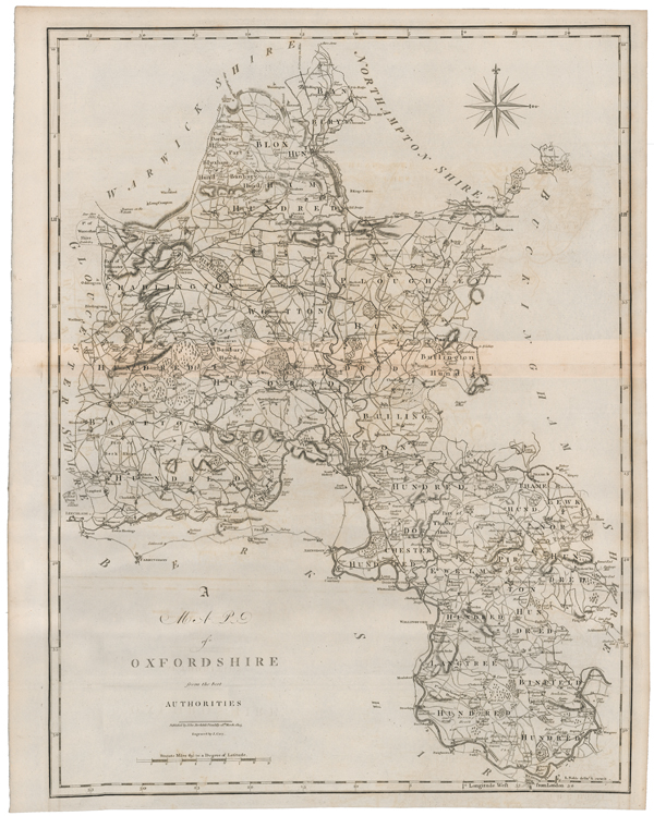
A detailed map of Oxfordshire, from the second edition of Gough's translation of Camden's Britannia. The maps for the Gough translation were commissioned to replace the Morden plates, which after a century of reprinting had become worn and outdated. The draughtsmanship for each map was undertaken by Edward Noble, with engraving by John Cary. County boundaries and the divisions of the Hundreds are outlined in hand colour, and Oxford is picked out in red, as are towns and larger villages. John Cary (1755-1835) was an English cartographer, engraver, globe maker and publisher, often working with his brothers George and Francis. In 1770, he was apprenticed to William Palmer, and became surveyor of roads to the general post office around 1794. He is best known for his English county atlases, particularly Cary's New and Correct English Atlas, published in 1787-1789, and the miniature Traveller's Companion. He also engraved the plates for Robert Gough's edition of Camden's Britannia, which was published in 1806. Edward Noble (fl.1771-1784) was a British draughtsman, mapmaker, and bookseller, best known for delineating the county maps for the Gough editions of Camden's Britannia, which were engraved by John Cary. William Camden (1551-1623) was a historian and antiquary whose works were reprinted and published over a period of 200 years. The original Latin text was first translated by Gibson in 1695. Morden was employed to replace the outdated maps by Saxton, engraved by Kip and Hole. He based his maps on manuscript sources plus the surveys of Ogilby and Morgan, Seller, Palmer and the coastal charts of Cpt. Greenville Collins. One of his original contributions to cartography was the showing of longitudes measured from the meridian of St. Paul's Cathedral given in the form of time in minutes at the top of the map in Roman numerals and at the bottom in degrees. This was done to clarify local times that were taken from the sun as there was no national standard time. Condition: Central horizontal folds as issued. Minor offsetting to map. Blank on verso. |
| Framing | unmounted |
| Price | £180.00 |
| Stock ID | 51653 |