
| Method | Copper engraved with hand colour |
| Artist | Sudlow, Edward |
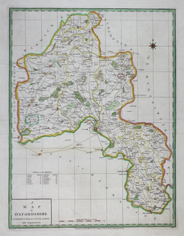
| Published | Heywood delt. Sudlow fc. Engraved for John Harrison, No. 115, Newgate Street as the Act directs Nov.r 23, 1787 |
| Dimensions | 436 x 330 mm |
| Notes |
A late-eighteenth century folio map of the county of Oxfordshire, engraved by Sudlow for a companion atlas to Tindal's English translation of Rapin de Thoyras' Histoire d'Angleterre. The atlas was published by John Harrison, who subsequently reused the plates for his 1791 Maps of the English Counties. The map shows the road network of the county, a features a key to the Hundreds in the bottom left corner. County boundaries and the divisions of the Hundreds are outlined in hand colour, and key locations, including Oxford, are picked out in red. The map features a simple compass rose in the top right, and is graticuled. Edward Sudlow (fl.1784-1793) was a British fan maker, engraver, and mapmaker who held premises at 191 Strand. John Haywood, sometimes Heywood, (fl.1781-1792) was a British mapmaker, draughtsman, and engraver. His maps and plans were engraved by Sudlow, Thomas Bowen, Neele, Faden, and others. Condition: Horizontal folds as issued. Professional backed with archival tissue. Blank on verso. |
| Framing | unmounted |
| Price | £200.00 |
| Stock ID | 50187 |