
| Method | Copper engraved with hand colour |
| Artist | Owen, John and Bowen, Emanuel |
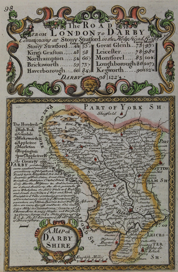
| Published | 1720 |
| Dimensions | 118 x 115 mm |
| Notes |
A finely engraved and decorative map of Derbyshire from Owen and Bowen's 'Britannia Depicta', first published in 1720. This atlas was undoubtedly one of the most popular of the eighteenth century. It was a pocket-sized atlas of county maps and strip road maps, based on John Ogilby's famous road book of 1675. The maps are immensely detailed and finely engraved, and include, within decorated cartouches, information regarding market days, distances and such like pertaining to the county shown. The verso shows a three-panel strip map of the road from Midhurst to Petersfield to Winchester. Bowen, Emanuel (c.1693-1767) was one of the leading eighteenth century map and print sellers and engravers in London. Appointed Engraver of maps to George II of England and possibly Louis XV of France. His apprentices included Thomas Kitchin and Thomas Jeffreys. He collaborated with other map makers of his time, including the Bowles family and John Owen. Condition: Trimmed to plate at right, not affecting map. |
| Framing | unmounted |
| Price | £75.00 |
| Stock ID | 48057 |