
| Method | Copper engraved |
| Artist | Toms, William Henry after Badeslade, Thomas |
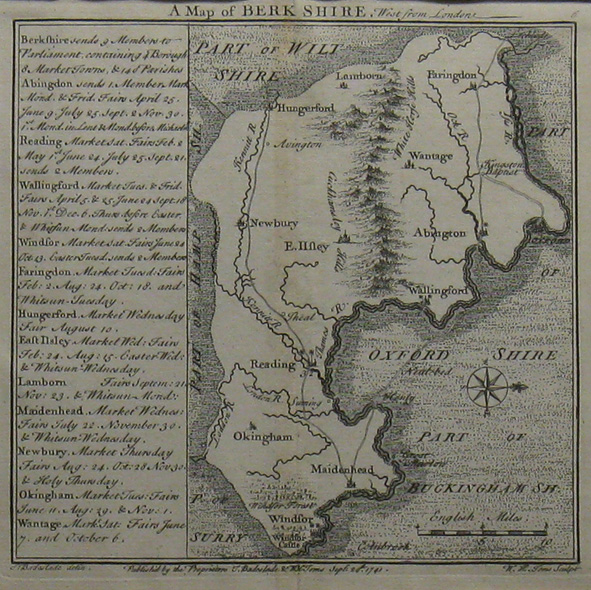
| Published | Publish'd by the Proprieters T. Badeslade & W.H. Toms Septr. 29th 1741 |
| Dimensions | 144 x 147 mm |
| Notes |
A map from 'Chorographia Britanniæ' Or 'A Set of Maps of all the Counties in England and Wales'. This atlas features a wonderful series of small British county maps designed by Thomas Badeslade during the middle of the eighteenth century. William Henry Toms helped publish the atlas and engraved the images after Thomas Badeslade. Each county map is strongly engraved, often with an unusual orientation and presented with extra information. Thomas Badeslade (fl. 1719-1745) was a surveyor, engineer, and author, and these maps are based upon his surveys. William Henry Toms (c. 1700-1750) was a British printmaker. He was a student of John Boydell (1719-1804) and he engraved plates for West's 'Perspective Views of All the Ancient Churches' in London and Badeslade's 'Chorographia Britanniæ'. |
| Framing | unmounted |
| Price | £45.00 |
| Stock ID | 6186 |