
| Method | Copper engraved with hand colour |
| Artist | Osborne, John and Thomas |
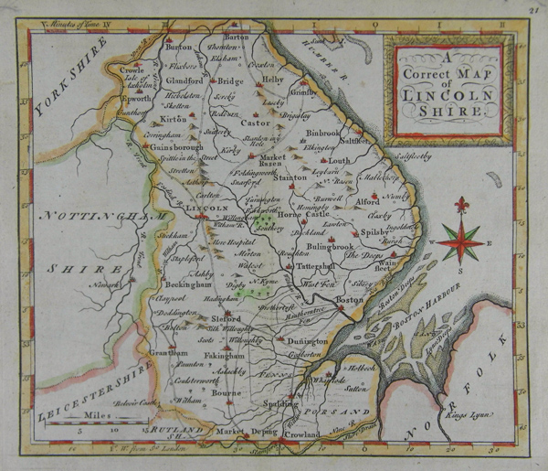
| Published | c. 1749 |
| Dimensions | 145 x 167 mm |
| Notes |
From Geographia Magnae Britanniae or Correct Maps of all the counties in England, Scotland and Wales, and of Several Adjacent Islands... John and Thomas Osborne published a number of cartographic works. They co-operated in the production of Thomas Salmon's 'Modern History' (1744-6), and in 1748 produced an attractive set of county maps entitled 'Geographia Magnae Britanniae' ('Correct maps of all the counties in England, Scotland, and Wales, and of several adjacent islands...') The title-page of this work is dated 1748. An edition published c. 1756 with a revised title-page has been recorded. Its life was short however, overtaken by sales of new atlases by Bowen and Kitchin. |
| Framing | mounted |
| Price | £60.00 |
| Stock ID | 37886 |