
| Method | Copper engraved |
| Artist | Gibson, John |
| Published | J.Gibson Sculp [Gentleman's Magazine, Vol 30. London, 1760] |
| Dimensions | 235 x 178 mm |
| Notes |
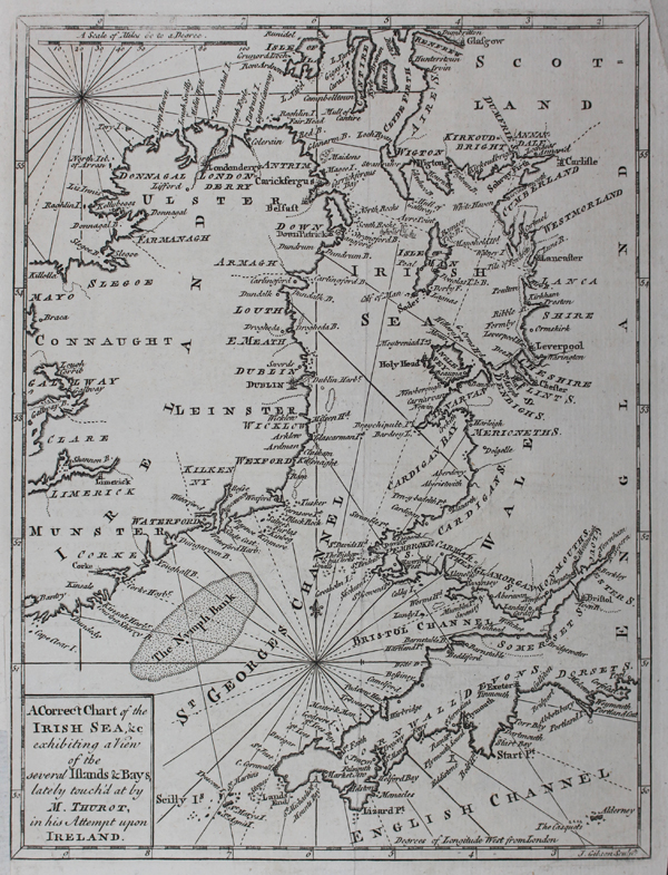
A detailed eighteenth century map of the Irish Sea and St George's Channel, from the Gentleman's Magazine. The map shows most of Ireland, as well as the western coasts of England, Wales, and southern Scotland. Nymphe Bank is shown as a large dotted section off the coast of Cork, and the seas are criss-crossed with rhumb lines. The map purports to focus upon the movements of the French-Irish privateer, Francois Thurot, who finally met his end in 1760 in battle with the British Navy off the coast off Carrickfergus after a partially successful raid on Belfast and Derry. The location of the battle, midway between the Irish coast and the Isle of Man, is plotted on the map as a small vignette of six ships. John Gibson was an English cartographer and engraver active between 1750 and 1792. Recognised as an important figure in late eighteenth-century British cartography, Gibson was a skilled engraver. A contemporary of Jacques-Nicolas Bellin, he produced thousands of maps, despite spending most of his life in prison because of debts. Gibson is best-known for the pocket atlas, Atlas Minimus (1858). He also published work in The Gentleman's Magazine, The Universal Magazine, The Universal Museum and The Universal Traveller. Condition: Vertical and horizontal folds as issued, repaired tear to Welsh coastine. Trimmed to border at bottom left as issued, reinstated. |
| Framing | unmounted |
| Price | £100.00 |
| Stock ID | 47676 |