
| Method | Etching |
| Artist | Moule, Thomas |
| Published | [London, c. 1848] |
| Dimensions | 255 x 210 mm |
| Notes |
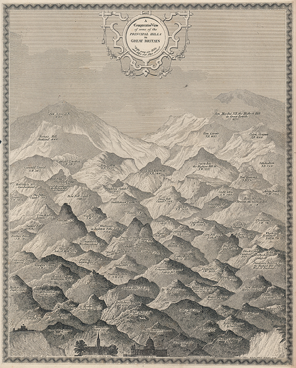
An illustration of the relative sizes of British hills and mountains, created by Moule for Barclay's 'A Complete and Universal English Dictionary of the English Language.' Ben Nevis and Ben Macdui tower in the distance. Salisbury Cathedral, Saint Paul's and Greenwich Observatory have been added to the bottom of the print to give a sense of scale and to illustrate the magnitude of nature over the achievements of humankind. Interestingly, Ben Macdui, and not Ben Nevis, is shown as being the highest peak in Great Britain. The title is enclosed in a decorative filigree cartouche, above a quote that reads: "Hills peep o'er Hills, and Alps o'er Alps arise," the final line of Pope's 'A Little Learning.' Originally a writer on heraldry and general antiquities, Thomas Moule (1784-1851) was an engraver born in Marylebone, London. From around 1816 to 1823 he was a bookseller with a shop in Grosvenor Square, London. He then became an inspector of letters in the General Post Office, where his responsibilities included trying to 'read' illegible hand writing. He is best known for his highly decorated county maps of England, steel-engraved and first published separately between 1830 and 1832. Condition: Time toning to edges of sheet. Small chip to left edge of sheet. |
| Framing | unmounted |
| Price | £95.00 |
| Stock ID | 53483 |