
| Method | Steel engraved with original hand colour |
| Artist | Wyld, James |
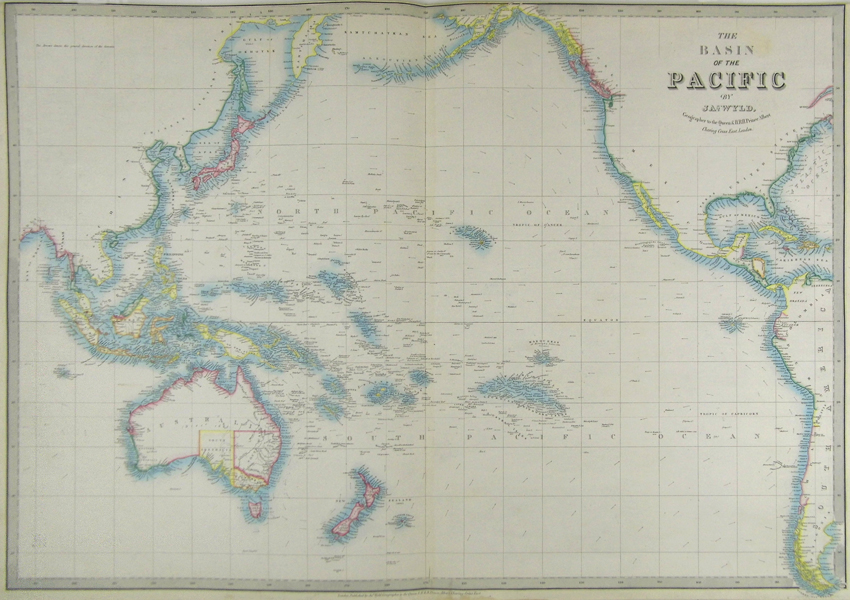
| Published | London. Published by Jas. Wyld, Geographer to the Queen & H.R.H. Prince Albert, Charing Cross East. 1854 |
| Dimensions | 578 x 834 mm |
| Notes |
A large-scale hand coloured map of the islands of the Pacific Ocean from James Wyld's A New General Atlas of Modern Geography. The map covers the area from the Bay of Bengal in the West to the West Indies in the East, including the coast lines of Asia and the Americas. James Wyld (1812-1887) was a British publisher and cartographer. His greatest geographical achievement was Wyld's Great Globe, exhibited in Leicester Square between 1851 and 1862. The globe, sixty feet high and lighted with gas, was at that point the largest ever constructed. He was geographer to Queen Victoria and H.R.H. Prince Albert. Condition: Centre fold, as issued. Some discolouration in lower margin, not affecting image. |
| Framing | unmounted |
| Price | £250.00 |
| Stock ID | 41867 |