
| Method | Steel engraved with hand colour |
| Artist | Starling, Thomas after Creighton, Roger |
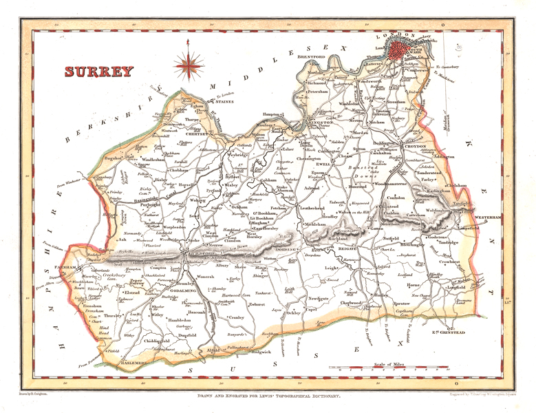
| Published | Drawn by R. Creighton. Engraved by T. Starling, Wilmington Square. Drawn and Engraved for Lewis' Topographical Dictionary. [c.1830] |
| Dimensions | 178 x 230 mm |
| Notes |
A detailed map of Surrey, ornamented with outline hand colour and with Southwark picked out in red, from Lewis' Topographical Dictionary. Thomas Starling (1796-1850) was a British mapmaker, printer, publisher, and engraver, known mostly for a series of miniature maps which were published as the Cabinet Atlas, before being reissued and serialised by a number of different publishers. Baynton-Williams suggests that he was likely the brother of the printer Parlett Starling and the bookseller James Kearsley Starling. Roger Creighton (1796-1838) was a British draughtsman and land surveyor, principally known for working on Greenwood's county maps and Samuel Lewis' Topographical Dictionary. Samuel Lewis (1782-1865) was the editor and publisher of topographical dictionaries and maps of the United Kingdom of Great Britain and Ireland. The aim of the texts was to give in 'a condensed form', a faithful and impartial description of each place. The firm of Samuel Lewis and Co. was based in London. Samuel Lewis the elder died in 1865. His son of the same name predeceased him in 1862. A Topographical Dictionary of England contains every fact of importance tending to illustrate the local history of England. Arranged alphabetically by place (village, parish, town, etc.), it provides a faithful description of all English localities as they existed at the time of first publication (1831), showing exactly where a particular civil parish was located in relation to the nearest town or towns, the barony, county, and province in which it was situated, its principal landowners, the diocese in which it was situated, and-of great importance-the Roman Catholic district in which the parish was located and the names of corresponding Catholic parishes. There were six subsequent editions, the last of which (1848-9) was in four volumes and an atlas. Condition: Splitting to platemark along left margin, not affecting map. Blank on verso. |
| Framing | unmounted |
| Price | £45.00 |
| Stock ID | 51443 |