
| Method | Copper engraved with hand colour |
| Artist | Moll, Herman |
| Published | Swale & Child, London, 1695 |
| Dimensions | 135 x 180 mm |
| Notes |
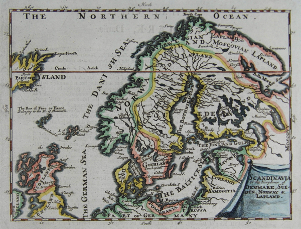
An uncommon map of Scandinavia at the end of the 17th century from Thesaurus Geogrphicus. This maps shows Sweden comprising of all the territory which is now Finland. Herman Moll (c.1654-1732) was born in Germany and came to England in the 1670s. He worked as an independent cartographer and geographer, and traded as a map publisher and seller for two years, and then worked for other publishers. Moll established his own business and eventually dominated the early eighteenth century map trade. He produced many maps and atlases of England, Wales, Scotland and Ireland. His county maps were all boldly engraved in a heavy style. Moll was also an active member in academic and intellectual circles, being a close associate of Daniel Defoe, Robert Boyle, Robert Hooke, and, most importantly for his cartographic career, the pre-eminent English explorer of the era, William Dampier. |
| Framing | unmounted |
| Price | £185.00 |
| Stock ID | 36108 |