
| Method | Copper engraved |
| Artist | [Anonymous] |
| Published | Prag 1810 |
| Dimensions | 194 x 252 mm |
| Notes |
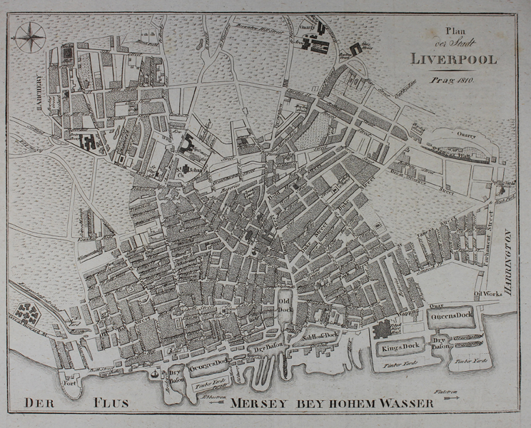
An early nineteenth century German city map of Liverpool, most likely engraved for one of the numerous volumes of the Neueste Länder- und Völkerkunde, a German primer featuring articles of geographical and ethnographic interest. The River Mersey runs along the bottom edge of the map, with the various docks and basins shown in detail. Condition: Vertical and horizontal folds as issued. Blank on verso. |
| Framing | unmounted |
| Price | £95.00 |
| Stock ID | 49089 |