
| Method | Copper engraved |
| Artist | Chatelain, Henri Abraham |
| Published | Avec Privilege de Nos Seigneurs les Etats de Hollande et de Westfrize [Amsterdam, c.1719] |
| Dimensions | 355 x 465 mm |
| Notes |
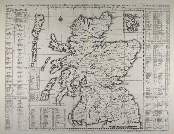
A large and attractive map of Scotland from Chatelain's 7 volume Atlas Historique, with a small inset map of the Orcadian islands at top right. The map is exhaustively annotated to left and right with boxed lists of the principle Scottish dukes, marquises, counts, viscounts, and barons with their corresponding territories, as well as a thorough listing of principle cities, towns, villages, and regions. Henri Abraham Chatelain (1684 - 1743) was a Dutch cartographer of Parisian origins, who lived and worked in St. Martins, London (c. 1710), The Hague (c. 1721), and Amsterdam (c. 1728). He is best known for the seminal seven volume Atlas Historique (published in Amsterdam, 1705 - 20) which combined maps and topography with scholarly studies of geography, history, ethnology, heraldry, and cosmography. The Atlas was a family undertaking, managed by Henri and his father, Zacharie, and going through a number of editions. The majority of the maps for the work were engraved by Henri after charts by De L'Isle. Condition: Central vertical fold as issued. Some light foxing near central fold. |
| Framing | unmounted |
| Price | £375.00 |
| Stock ID | 38738 |