
| Method | Copper engraved with hand colour |
| Artist | Chatelain, Henri Abraham |
| Published | [Amsterdam, 1719] |
| Dimensions | 45 x 500 mm |
| Notes |
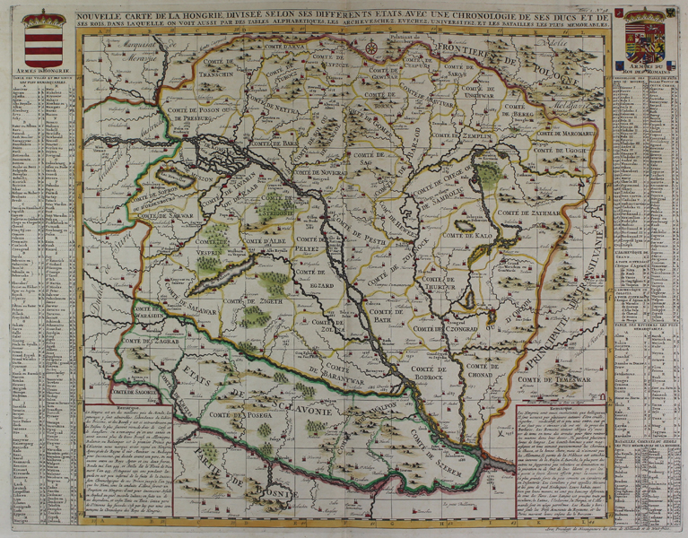
A detailed large format map of the Hungarian Empire, naming the countries and royal regions throughout, from Chatelain's Atlas Historique. The numerous towns and villages are indicated with various sized icons. Map extends to Bosnia, Slovenia, Temeswar, to the Saw River in the south to Moravia, and the Frontiers of Poland in the north. Centred on the course of the Danube from Vienna to Belgrade. Includes the royal coat-of-arms of Hungary and the Roman Empire at the two top corners. At the sides are extensive listings of all the towns, cities and rivers, as well as military battles and sieges. Henri Abraham Chatelain (1684 - 1743) was a Dutch cartographer of Parisian origins, who lived and worked in St. Martins, London (c. 1710), The Hague (c. 1721), and Amsterdam (c. 1728). He is best known for the seminal seven volume Atlas Historique (published in Amsterdam, 1705 - 20) which combined maps and topography with scholarly studies of geography, history, ethnology, heraldry, and cosmography. The Atlas was a family undertaking, managed by Henri and his father, Zacharie, and going through a number of editions. The majority of the maps for the work were engraved by Henri after charts by De L'Isle. Condition: Folds, as issued. |
| Framing | unmounted |
| Price | £250.00 |
| Stock ID | 45338 |