
| Method | Copper engraved with hand colour |
| Artist | Ortelius, Abraham |
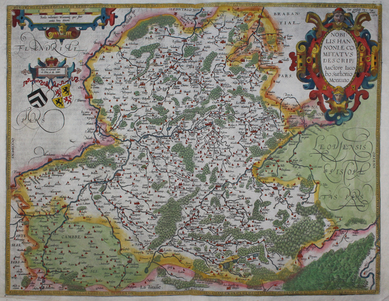
| Published | Cum privilegiis Imp. et Regi Maitis ad decenn. 1579 [1588 printing] |
| Dimensions | 365 x 485 mm |
| Notes |
A hand coloured map of Hannonia, the Hainaut province of Belgium. From the 1588 Spanish edition of Ortelius' 'Theatrum Orbis Terrarum'. Includes the cities of Charleroi, Ath, Tournay, Valenciennes, Maubeuge and its capital Mons. Rivers and forests have been included in lovely detail, along with towns, churches and cathedrals. Motto and crests included in left corner. Title in a decorative strapwork cartouche decorated with two classicised heads. With Spanish text to verso. Abraham Ortelius (1527 -1598) was a Flemish cartographer, cosmographer, geographer and publisher and a contemporary of Gerard Mercator, with whom he travelled through Italy and France. Although it is Mercator who first used the word "Atlas" as a name for a collection of maps, it is Ortelius who is remembered as the creator of the first modern atlas. 'Theatrum Orbis Terrarum' was the first systematically collated set of maps by different map makers in a uniform format. Three Latin editions as well as a Dutch, French and German edition of 'Theatrum Orbis Terrarum' were published by 1572 and a further 25 editions printed before Ortelius' death in 1598. Several more were subsequently printed until around 1612. Ortelius is said to have been the first person to pose the question of the continents once being a single land mass before separating into their current positions. Condition: Time toning and surface stains. Central fold as issued. |
| Framing | unmounted |
| Price | £300.00 |
| Stock ID | 45525 |