
| Method | Copper engraved with hand colour |
| Artist | Cary, John |
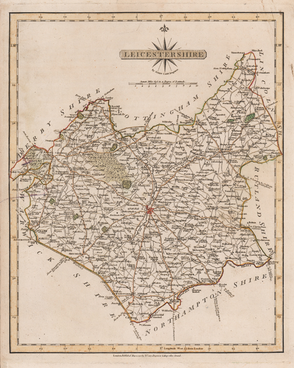
| Published | By John Cary Engraver. London: Published May 1. 1792 by J. Cary, Engraver & Mapseller Strand. |
| Dimensions | 265 x 212 mm |
| Notes |
A detailed map of Leicestershire, from Cary's 'New and Correct English Atlas.' John Cary (1755-1835) was an English cartographer, engraver, globe maker and publisher, often working with his brothers George and Francis. In 1770, he was apprenticed to William Palmer, and became surveyor of roads to the general post office around 1794. He is best known for his English county atlases, particularly Cary's New and Correct English Atlas, published in 1787-1789, and the miniature Traveller's Companion. He also engraved the plates for Robert Gough's edition of Camden's Britannia, which was published in 1806. Condition: Trimmed to platemark along left margin, as issued. Small tears and chips to edges of sheet. Horizontal crease. Minor dirt-staining to margins. |
| Framing | unmounted |
| Price | £45.00 |
| Stock ID | 51531 |