
| Method | Copper engraved with hand colour |
| Artist | Sanson d'Abbeville, Nicolas |
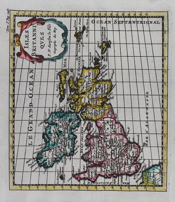
| Published | P.N. Sanson le Fils, Geographe du Roy [Bruzen de la Martiniere , Amsterdam, 1743] |
| Dimensions | 145 x 165 mm |
| Notes |
A small map of the British Isles, oriented with west to top, from the 'Introduction a 'L'Histoire Generale et Politique de L'Univers', by Baron de Pufendorff. The borders of Ireland, Scotland, and England and Wales are outlined in different hand colours, and the title is enclosed in a decorative oval strap cartouche. Nicholas Sanson (1600 - 1667) was a French engraver and cartographer, and Geographer to Louis XIII and Louis XIV. As well as world maps, he also issued a series of historic maps to accompany popular classical texts like Caesar's Gallic Wars. After his death, he was succeeded by his sons Adrien and Guillaume, who frequently sign their work Sanson fils. Condition: Vertical fold as issued. Light thumb print in black ink to right margin, not affecting map. |
| Framing | unmounted |
| Price | £85.00 |
| Stock ID | 46841 |