
| Method | Copper engraved with hand colour |
| Artist | Bertius, Petrus |
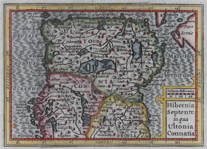
| Published | [Amsterdam 1639] |
| Dimensions | 93 x 122 mm |
| Notes |
A miniature map of north Ireland by Petrus Bertius, from 'Guili. Camdeni Viri Clarissimi Britannia sive florentiss. Regnorum Angliae, Scotiae, Hiberniae..' by William Camden, published by William Blaeu. A finely detailed map featuring notable towns and mountains. Petrus Bertius (14th November 1565 – 13th October 1629) was a Flemish theologian, historian, geographer and cartographer and was related to Jodocus Hondius Sr. and Pieter van den Keere by marriage. Bertius studied at the University of Leiden and later traveled in Germany and Russia. In 1620 he emigrated to France where he was appointed as a cosmographer to the court Louis XIII. Bertius published a number of folio maps, but never published an atlas of his own. His maps were either separately published or included in atlases and books by other publishers. Condition: Pressed vertical folds, as issued. |
| Framing | mounted |
| Price | £150.00 |
| Stock ID | 46722 |