
| Method | Chromolithograph |
| Artist | T. Hallissy after W.H. Clarke |
| Published | [Ordnance Survey Office, Dublin, 1928] |
| Dimensions | Image 500 x 440 mm |
| Notes |
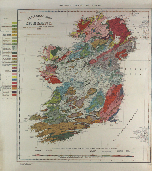
A detailed geological map of Ireland with the different counties and provinces, cities, rivers and major roads. A coloured index is included indicating the geological makeup of each band. This map was first published individually by the Irish Ordnance Survey Office in Dublin in 1928 and was then revised and reprinted in 1962. The inscription underneath the image reads: 'Prepared by T. Hallissy, B.A., M.R.I.A., Senior Geologist W.H. Clarke, Draughtsman.' Condition: Creasing, light dirt build-up and foxing to margins. Left margin trimmed. |
| Framing | unmounted |
| Price | £300.00 |
| Stock ID | 43075 |