
| Method | Chromolithograph |
| Artist | George Philip & Son Ltd. |
| Published | The London Geographical Institute c.1920 |
| Dimensions | Each sheet 285 x 370 mm, Whole map 865 x 1110 mm |
| Notes |
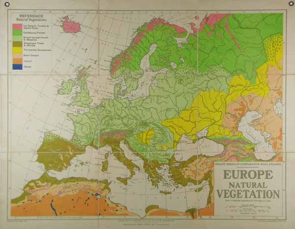
A large folding wall map of Britain dissected into nine sheet and laid to linen. This map shows the natural vegetation across Europe with a key in the top left corner outlining ice, desert, forest, trees and shrubs, Grasslands and Oases. The scale of this map is 100 miles to 1 inch. Condition: Light dirt build up to sheet. Includes the original eye holes for hanging. London County Council library stamp on the verso. |
| Framing | unmounted |
| Price | £200.00 |
| Stock ID | 38744 |