
| Method | Copper engraving |
| Artist | Moll, Herman |
| Published | [1729] |
| Dimensions | 200 x 263 mm |
| Notes |
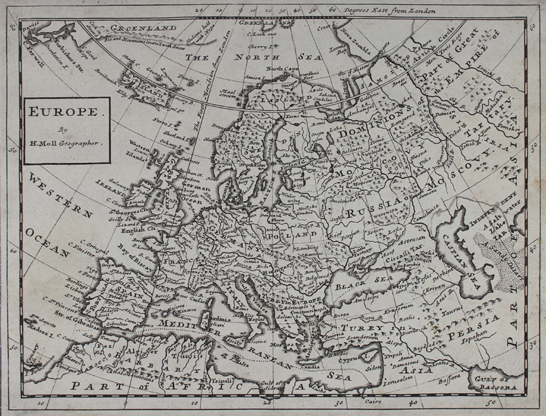
A miniature map of Europe. The map largely shares its cartography with Moll's large map of Europe from the previous decade. The map was later included in his 'Atlas Minor', published by Thomas and John Bowles c. 1732-1736 in London. Herman Moll (c.1654-1732) was born in Germany and came to England in the 1670s. He worked as an independent cartographer and geographer, and traded as a map publisher and seller for two years, and then worked for other publishers. Moll established his own business and eventually dominated the early eighteenth century map trade. He produced many maps and atlases of England, Wales, Scotland and Ireland. His county maps were all boldly engraved in a heavy style. Moll was also an active member in academic and intellectual circles, being a close associate of Daniel Defoe, Robert Boyle, Robert Hooke, and, most importantly for his cartographic career, the pre-eminent English explorer of the era, William Dampier. Condition: Light staining to left and right of sheet. |
| Framing | unmounted |
| Price | £180.00 |
| Stock ID | 45355 |