
| Method | Copper engraved with hand colour |
| Artist | Moll, Herman |
| Published | [London, c. 1724] |
| Dimensions | 209 x 255 mm |
| Notes |
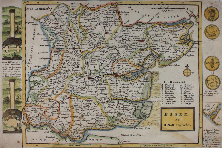
A decorative county map featuring vignettes in the borders with 'A Plan of ye Lati Breach of Dagenham', Artificial Caverns near Tilbury, as well as various antique coins. Herman Moll's county maps were first published in 'A New Description of England and Wales' in 1724. The maps were reissued in various editions by the Bowles brothers and C. Rivington after Moll's death, until the last publication in 1753. Herman Moll (c.1654-1732) was born in Germany and came to England in the 1670s. He worked as an independent cartographer and geographer, and traded as a map publisher and seller for two years, and then worked for other publishers. Moll established his own business and eventually dominated the early eighteenth century map trade. He produced many maps and atlases of England, Wales, Scotland and Ireland. His county maps were all boldly engraved in a heavy style. Moll was also an active member in academic and intellectual circles, being a close associate of Daniel Defoe, Robert Boyle, Robert Hooke, and, most importantly for his cartographic career, the pre-eminent English explorer of the era, William Dampier. Condition: Strong impression with full margins. Light water staining to margins and into map. Insect hole to lower left corner, not affecting map. |
| Framing | mounted |
| Price | £175.00 |
| Stock ID | 43445 |