
| Method | Copper engraved with hand colour |
| Artist | Kitchin, Thomas |
| Published | [Printed for J. Knox, London, 1767] |
| Dimensions | 180 x 290 mm |
| Notes |
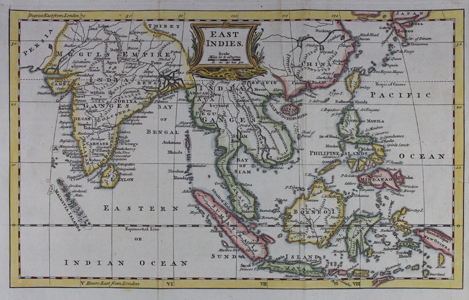
An eighteenth century map of the East Indies, from 'A New Collection of Voyages, Discoveries and Travels.' The map shows the Indian subcontinent, China, and south east asia, including the Philippines, the spice islands, and the eastern part of New Guinea. Regional borders are outlined in hand colour, and reefs, rivers, and mountains are depicted pictorially. At top centre, the title and scale are enclosed in a baroque scalloped cartouche. Thomas Kitchin (1718-1784) was one of the best and most prolific engravers of the eighteenth century. He issued The General Atlas, Describing the Whole Universe, first published in 1773, and regularly reissued thereafter. His work also included a large number of maps of the English counties, particularly for the London Magazine (1747-1760), the Universal Magazine (1747-1766), and for Dodsley's England Illustrated (1764). Other maps were published in conjunction with Emanuel Bowen in the Large English Atlas and the Royal English Atlas (1763). Condition: Vertical folds as issued. Some creasing and abrasion to folds. Small tear to right margin. |
| Framing | unmounted |
| Price | £175.00 |
| Stock ID | 47361 |