
| Method | Copper engraved |
| Artist | [Anonymous] |
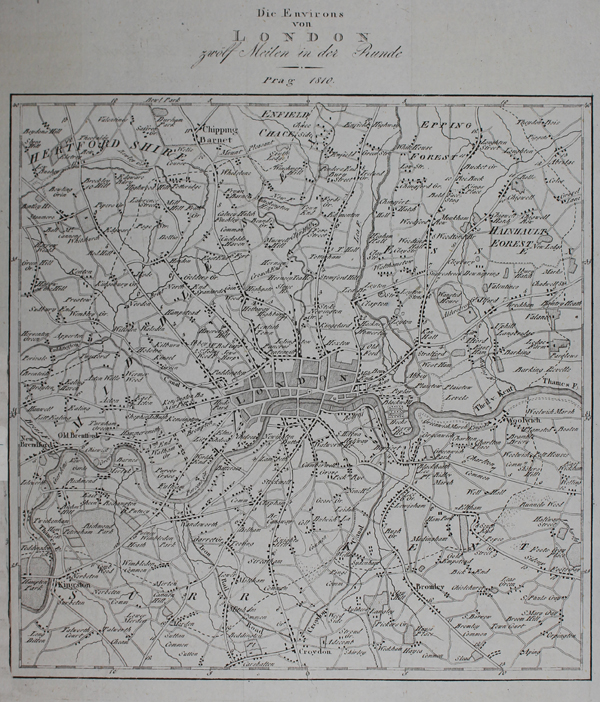
| Published | Prag 1810. |
| Dimensions | 240 x 205 mm |
| Notes |
An early nineteenth century German city map of the environs of London, most likely engraved for one of the numerous volumes of the Neueste Länder- und Völkerkunde, a German primer featuring articles of geographical and ethnographic interest. The map shows the area up to 12 miles from the city, encompassing Middlesex, as well as parts of Hertfordshire, Surrey, Kent, and Essex. London itself is shown in a basic city-block map, while surrounding towns, villages, and structures are shown as black rectangles. Between Wandsworth and Croydon, the 'Iron Rail Road' is marked as a dotted line. Condition: Vertical and horizontal folds as issued. Trimmed to border of map on bottom half of left margin, as issued. Blank on verso. |
| Framing | unmounted |
| Price | £100.00 |
| Stock ID | 49090 |