
| Method | Copper engraved with hand colour |
| Artist | von Reilly, Franz Johann Joseph |
| Published | c. 1790 |
| Dimensions | |
| Notes |
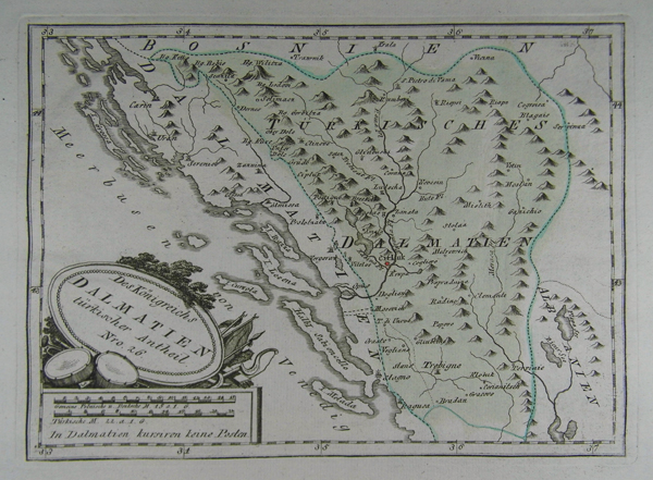
A map of the southern Dalmatian coast in Croatia with Ragusa or Dubrovnik in the south and the islands of Miljet, Korcula, Stari-Grad and Brac. Decorative title engraved in an oval upon drums, trumpets and flags. Franz Johann Joseph Reilly (1766 - 1820) was an Austrian publisher , cartographer and writer. Reilly produced over 830 maps for his great atlas project, "Schauplatz der funf Theile der Welt" between the years 1789 and 1806. Of these 830 maps published over this time span of seventeen years, he 'showcased' only one part of the world, Europe. Maps of the other four continents remained unpublished. The maps of the "Schauplatz ..."were drawn to a uniform criteria. |
| Framing | unmounted |
| Price | £170.00 |
| Stock ID | 37854 |