
| Method | Steel engraved with hand colour |
| Artist | Neele, Samuel John |
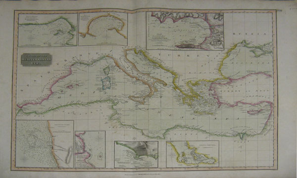
| Published | Drawn and engraved for Thomson's New General Atlas, 1817. |
| Dimensions | 488 x 598 mm |
| Notes | Chart of the Mediterranean Sea. with Bay & roads of Marseilles. with The harbour of Genoa. with Plan of the rock and bay of Gibraltar shewing the position of the combined fleet and attack of the battering ships in 1782. with Leghorn Road. with Sketch of the watering place of Algeziras. with Attack on Algiers by the fleet under the command of Adml. Lord Exmouth, Augst. 27th 1816. with Gulf of Smyrna |
| Framing | unmounted |
| Price | £300.00 |
| Stock ID | 23152 |