
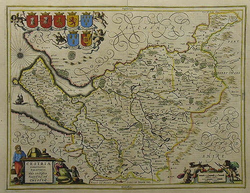
| Method | Copper engraved with original hand colour |
| Artist | Blaeu, Willem Janszoon |
| Published | Amstersdam c.1646 |
| Dimensions | 378 x 494 mm |
| Notes |
The Blaeu family were one of the most famous publishers of maps, globes and atlases during the 16th century. Cartographers, globe makers and booksellers the Blaeu's business flourished in Amsterdam for over 40 years, until a fire destroyed their premises in 1672 and losing all plates, prints and stock and effectively ruined the firm. Willem Blaeu founded the business in 1596 as a globe and instrument makers soon expanding into maps topography and sea charts. Atlas Novus was Willems great work, a major atlas intended to include the most up-to-date maps of the entire world. He issued the first two volumes in 1635 but died in 1638 before the atlas was completed. The running of the business past on to his sons Johannes and Cornelius. After the death of Cornelis in 1644, Johannes (Joan) continued the business alone and established his own reputation as a great mapmaker. Joan completed his father grand project in 1655 with the sixth and final volume of the Atlas Novus. This map of Cheshire contains the usual Blaeu decorations; including the royal coat of arms together with those of the noble families of the county and scenes of local life. A decorative title cartouche appears in the bottom left-hand corner and a Latinate description of the county is included in verso. Condition: Vertical fold as issued. Repaired tear to bottom and top of centre fold. Creasing to the right-hand side of the sheet; image and plate affected slightly. Small tear to the left side. |
| Framing | unmounted |
| Price | £580.00 |
| Stock ID | 28184 |