
| Method | Copper engraved with hand colour |
| Artist | [Anonymous] |
| Published | [Louis Perisse, Lyon, 1799] |
| Dimensions | 176 x 218 mm |
| Notes |
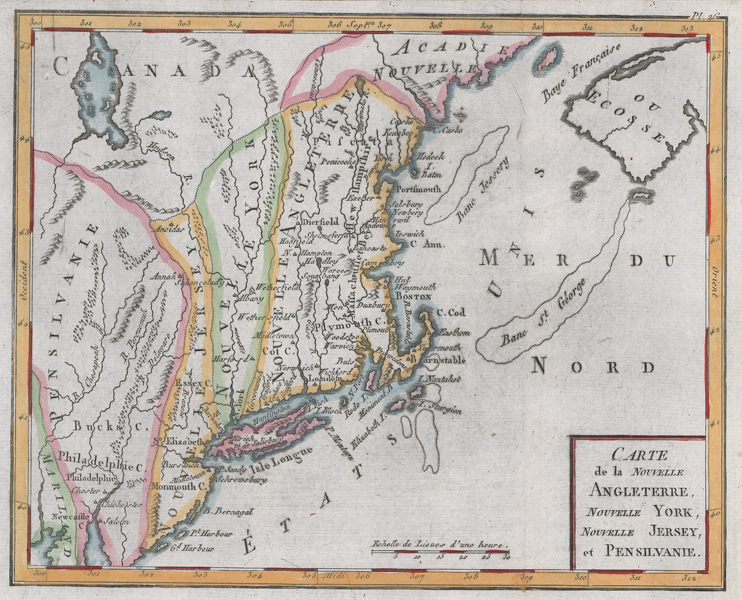
An unusual late eighteenth century map of New England, engraved for l'Abbe Bertholon's Atlas moderne portatif, composé de trente cartes sur toutes les parties du globe terrestre, et de trois cartes astronomiques, a l usage des Jeunes gens. The cartography for the map is surprisingly poor, with the borders of the Union's principal States shown in a fairly rudimentary manner. Maryland, Pennsylvania, New Jersey, and New York are the only States labelled, whiles the others are simply lumped together as 'Nouvelle Angleterre.' Maine, at this stage part of Massachusetts, is still listed under the old French title of Acadia, though Canada and New Scotland are named on either side. Despite the quirks of its geography, the map is ornamented in attractive outline colour, and mountain ranges are shown pictorially. The title is enclosed in a simple box cartouche in the bottom right corner. l'Abbé Pierre-Nicolas Bertholon de Saint-Lazare (1741-1800) was a French scientist and a member of the Académie des sciences et lettres de Montpellier. He is best known for his work on electrical currents. Condition: Vertical folds, as issued. Insect holes to bottom left corner of sheet, not affecting map. Blank on verso. |
| Framing | unmounted |
| Price | £180.00 |
| Stock ID | 52144 |