
| Method | Copper engraved |
| Artist | Scherer, Heinrich |
| Published | [Munich, c.1703] |
| Dimensions | 227 x 338 mm |
| Notes |
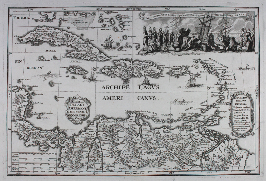
A finely engraved early eighteenth century map of the Caribbean, from Heinrich Scherer's Atlas Novus. The map stretches from the southernmost tip of Florida at top to northern South America at bottom, and from the Yucatan in the West to the Leeward and Windward Isles in the East. Each island is meticulously labelled with the names of principal ports, settlements, cities, rivers, and other key features. The seas are filled with sailing vessels, reefs, and sea monsters, and the map is further embellished by a number of decorative cartouches, one of which provides an alphanumeric key to the map, showing the colonial territories of the Spanish, French, British, Dutch, and Caribes. In the top right corner, an extensive vignette shows European merchants, explorers, and settlers interacting with the various native inhabitants of the Caribbean, and loading goods onto sailing ships belonging to Spain, France, and Britain. Heinrich Scherer (1628-1704) was a German cartographer, geographer, engraver, and publisher. A Professor of mathematics at Munich University, Scherer was also a devout Catholic, a facet of his life that is immediately apparent in his published works. His most famous publication was the Atlas Novus, an eight volume atlas produced between 1698 and 1710, which featured 187 plates depicting all of the known world, with particular reference to the activity of the Jesuit Order and the spread of Christianity around the world. Condition: Excellent dark, clean impression with full margins. Central vertical fold as issued. |
| Framing | unmounted |
| Price | £600.00 |
| Stock ID | 43103 |