
| Method | Chromolithograph |
| Artist | George Philip & Son Ltd. |
| Published | Printed in Great Britain by George Philip and Son, Limited, London. 1950 |
| Dimensions | Each sheet 355 x 298 mm Whole map 1096 x 895 mm |
| Notes |
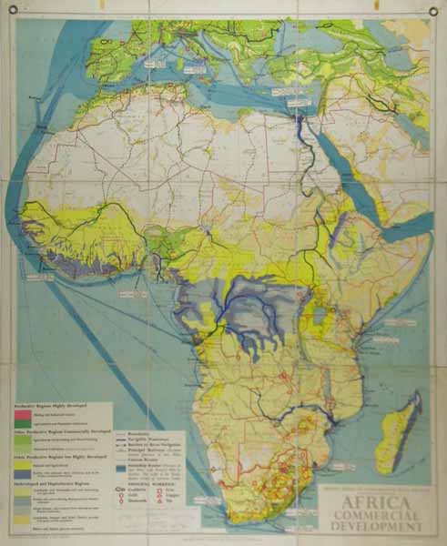
A large folding map of 9 sheets laid to linen with loop holes for hanging from the Philip's Series of Comparative Wall Atlases. Africa; Commercial Development outlines levels of productivity from highly developed to underdeveloped regions including agriculture and plantation, Mining industrial and commercial in the key on the left side and further information listing Exports and Imports on the map. Boundaries, waterways and railways shipping and air routes are also clearly shown. Scale approx 150 miles to 1 inch Condition:Slightly marked around the edges. |
| Framing | unmounted |
| Price | £200.00 |
| Stock ID | 38742 |