
| Method | Lithograph with hand colour |
| Artist | Rapkin, John |
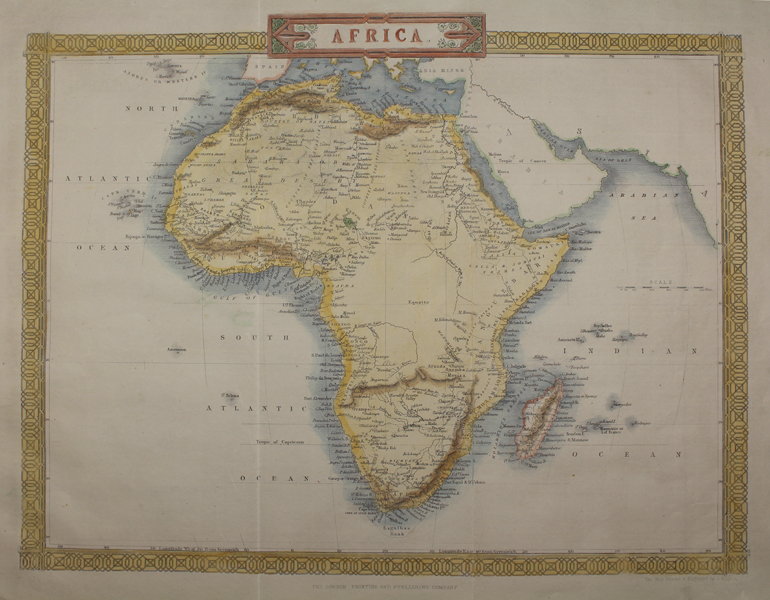
| Published | The London Printing and Publishing Company. The Map Drawn & Engraved by J. Rapkin. [c.1870] |
| Dimensions | 256 x 324 mm |
| Notes |
A decorative map of Africa, originally engraved in steel by Rapkin for Tallis' Illustrated Atlas. This example though is a lithographic copy, likely reproduced for a mid-Victorian encyclopaedia or similar. The continent, as well as mountain ranges and coasts, is washed in hand colour, and the map is enclosed by a decorative vegetal border. The vignettes which featured on the original map have here been removed. John Tallis was a British publisher and one of the most popular cartographers of the 19th Century. Tallis maps were highly valued for their accuracy, but perhaps more so for their charming vignettes and ornamentation. Engraved by John Rapkin, these maps were praised by the New York Sun as "the most accurate and most splendid publication of the kind ever issued". The Bristol Times observed that Mr. Tallis maps "are not only critically correct, but are accompanied with elegant and appropriate engravings illustrative of the manners and costumes of the different countries." John Rapkin was an engraver and mapmaker active in Britain in the mid-nineteenth century. He drew and engraved the maps for John Tallis' 'The Illustrated Atlas and Modern History of the World' (1845-51), which was later re-issued by the London Printing and Publishing Company. He also drew and engraved maps for R. Montgomery Martin's 'British Colonies, their history' (1849), and Wright's 'Universal Pronouncing Dictionary' (c.1850). Condition: Vertical folds as issued. Minor time toning to margins. Blank on verso. |
| Framing | unmounted |
| Price | £100.00 |
| Stock ID | 48734 |