
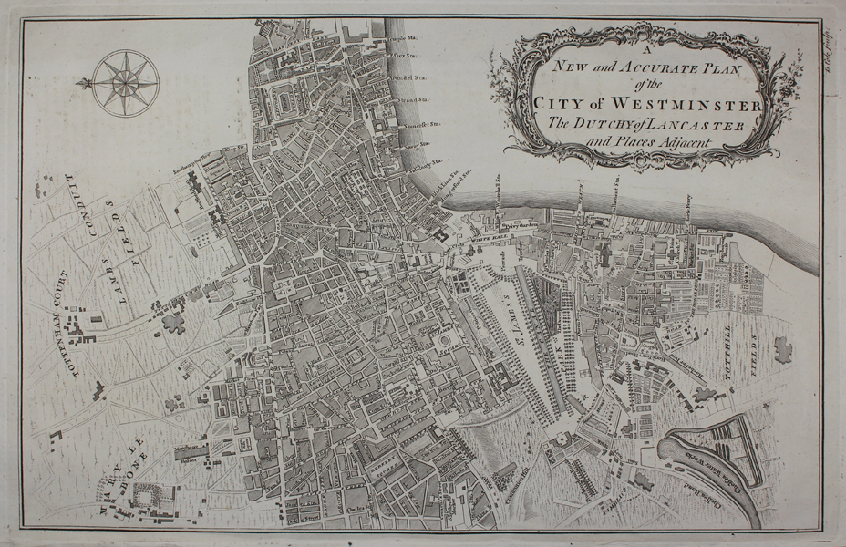
| Method | Copper engraved |
| Artist | Cole, Benjamin |
| Published | London: Printed for T. Osborne and J. Shipton, in Gray's-Inn; and J. Hodges, near London-Bridge, 1756. |
| Dimensions | 230 x 360 mm |
| Notes |
A map of Westminster from William Maitland's The History and Survey of London from it's Foundation to the Present Time showing the area from Marylebone and Tottenham Court to Totthill Fields. Benjamin Cole (1697-1783) was an English printmaker, who engraved, printed and sold prints from his shop at St Paul's Church in London. He also produced a wide variety of book illustrations, and is not to be confused with the near contemporary map engraver of the same name (1667-1729), who was active in Oxford. Condition: Minor offsetting on sheet. |
| Framing | unmounted |
| Price | £200.00 |
| Stock ID | 49945 |