
| Method | Copper engraved with hand colour |
| Artist | Kitchin, Thomas |
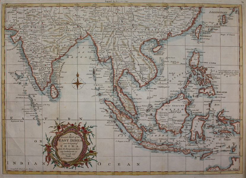
| Published | By T. Kitchin, Geogr. Engrav'd for the London Mag. [London, c.1761] |
| Dimensions | 298 x 420 mm |
| Notes |
An eighteenth century map of Asia, engraved by Kitchin for the London Magazine, and stretching from India in the West to China, Japan, and the Spice Islands in the East. In the bottom right corner, the northernmost limits of Australia, here marked New Holland, can be seen. The various islands, nations, and kingdoms of south-east Asia are thoroughly mapped, including Tonkin and Cochin (Vietnam), Camboja (Cambodia), Siam (Thailand) Pegu (Burma Myanmar), Malaya, Sumatra, Java, Borneo, the Celebes, the Philippines, and part of New Guinea. The Maldives feature a note about the the domicile of their king, reefs and sand banks are labelled, and a description off the coast of Cape Espiritu Santo notes the capture of the Acapulco Galleon by Commodore Anson. Sea coasts are outlined in hand colour, and principle cities, ports, and trading hubs are picked out in red. In the bottom left, a large ornate cartouche encloses the title. Thomas Kitchin (1718-1784) was one of the best and most prolific engravers of the eighteenth-century. Born in Southwark, he was an apprentice of Emanuel Bowen in 1732. Based in Clerkenwell and later Holborn Hill, Kitchin worked as royal hydrographer to the king from 1773. He married Sarah Bowen, daughter of Emanuel, in 1739, and then Jane, daughter of Joseph Burroughs, in 1762. He is best known for The World From the Best Authorities published in Guthrie's New Geographical Grammar (1777), The Small English Atlas (1749) with Thomas Jefferys, and The Large English Atlas (1749 - 60) with Emanuel Bowen. Condition: Vertical and horizontal folds as issued. Large crease to bottom left corner of sheet. |
| Framing | unmounted |
| Price | £450.00 |
| Stock ID | 45441 |