
| Method | Copper engraved with original hand colour |
| Artist | Buache, Jean Nicolas after Arrowsmith, Aaron |
| Published | [Dentu, Paris, 1804] |
| Dimensions | 245 x 200 mm |
| Notes |
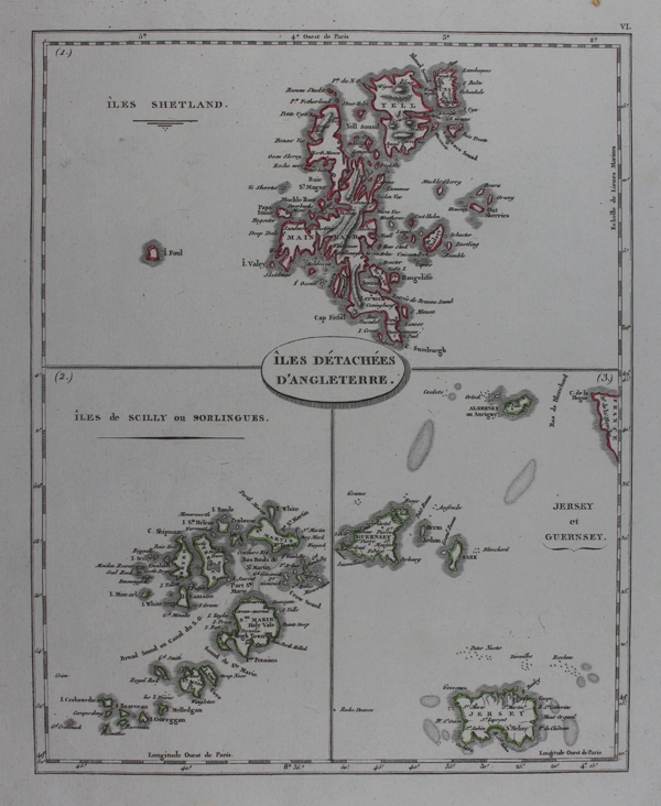
Three boxed maps on a single sheet showing the Shetlands, Scilly Isles, and Jersey and Guernsey, from the Geographie Moderne, Redigee sur un Nouveau Plan. Jean-Nicolas Buache, also known as Buache de La Neuville (1741-1825) was a French cartographer and last to bear the title 'Geographer to the King'. Elected member of the Academy of Sciences in 1770, he was commissioned by Louis XVI to draw up in 1788 the maps of the bailiwicks of the kingdom of France. The Arrowsmiths were a family of English mapmakers. The business was founded by Aaron Arrowsmith, Hydrographer to the Prince of Wales in c. 1810 and subsequently to the King in 1820. He was joined in 1810 by his nephew John Arrowsmith. After Aaron died in 1823, the business was continued by his sons Aaron Jr. and Samuel, who ran it until John took over the entire business. In 1863 he received the gold medal of the Royal Geographical Society, of which body he was one of the founders. Condition: Minor foxing to top and bottom margins of sheet. |
| Framing | unmounted |
| Price | £45.00 |
| Stock ID | 47148 |