
| Method | Copper engraved |
| Artist | Senex, John after Cellarius, Christophorus |
| Published | [Londini, Sumptibus S. Ballard, J. Senex, G. Innys, J. Osborn, & T. Longman, MDCCXXXI [London, 1731]] |
| Dimensions | 140 x 205 mm |
| Notes |
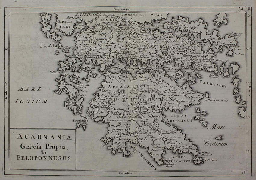
A detailed map of the Greek mainland during the classical era, most likely engraved by Senex for his 1731 edition of Geographia Antiqua, an atlas of Cellarius' work on classical geography. The map shows the various poleis and regional divisions of the ancient Greek mainland, as well as the adjoining Ionian islands and the islands of the Saronic Gulf. Christoph Keller (1638-1707), usually known as Cellarius, was a classical scholar and geographer, most famous for popularizing the division of European history into the ancient, medieval, and modern eras that are still in use today. His Historia Universalis was one of the most popular historical works of the eighteenth century, being republished and translated numerous times both during and after the author's lifetime, often with the addition of maps. John Senex (fl.1690-1740) was a British engraver, publisher, surveyor, and geographer to Queen Anne. Working with James Maxwell and Charles Price early in the 18th century, he produced some admirable maps of the world and continents including loose maps of many countries. In 1719 he issued a miniature, updated edition of Ogilby's 'Britannia'. This publication went through many editions and was inspired by the great interest he seemed to show in road maps. Condition: Central vertical fold as issued. Minor time toning to edges of sheet. Minor tear to bottom of central fold, not affecting map. Blank on verso. |
| Framing | unmounted |
| Price | £50.00 |
| Stock ID | 48991 |